A comprehensive digital resource for understanding the origins and meanings of England’s cities, towns, and villages. Originally launched in 2004-2005 with funding from the Arts and Humanities Research Council (AHRC), the platform has been completely rebuilt using modern web technologies while preserving its rich scholarly content.
The Challenge
The original KEPN platform, while rich in scholarly content, was built on legacy technology that had become increasingly difficult to maintain and extend. The user interface felt dated and the underlying architecture made it challenging to add new features or integrate with modern tooling.
Solution
This project is a complete ground-up rewrite of the KEPN platform, preserving the valuable research data while delivering a modern, responsive experience built on current web technologies.
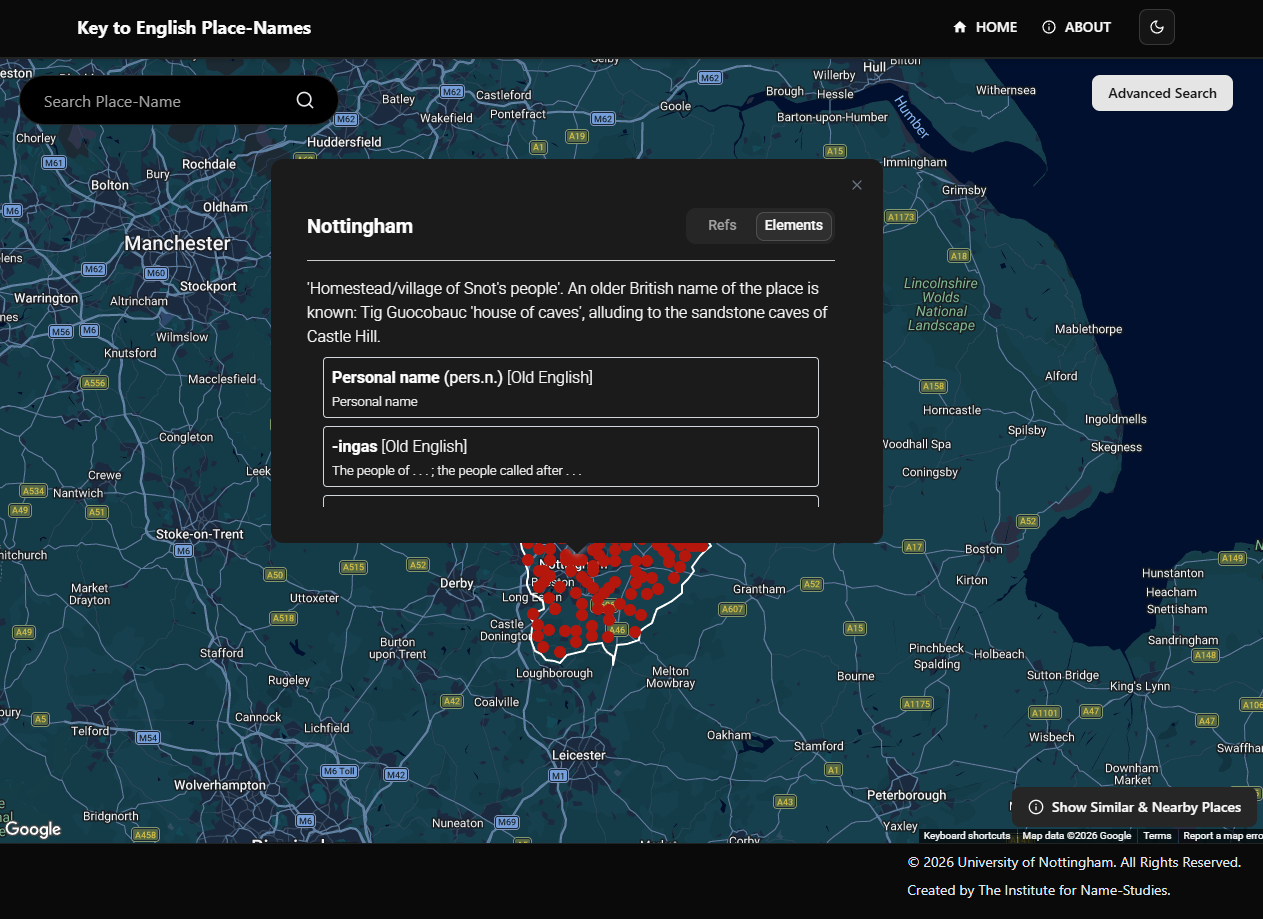
The new platform offers a searchable database accessed through an interactive Google Maps interface.
Users can search for place-names or browse by county to discover etymologies and meanings. Each place-name entry includes a breakdown of its constituent elements (e.g., “ham” meaning homestead, “ford” meaning river crossing) and the languages of origin (Old English, Old Norse, Celtic, etc.). The platform uses historical pre-1974 county boundaries to align with place-name research conventions.
The system includes authenticated editor tools for managing place-name data, elements, languages, and scholarly references.
This work is supported by a grant from the Arts and Humanities Research Council (AHRC).
Key features
Search
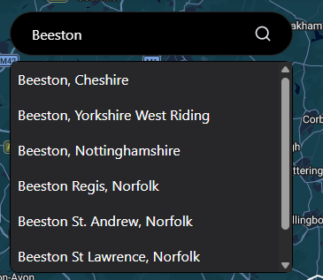
Users can search for individual place-names via the search bar, with the map centering on the selected location to display its etymology, constituent elements, and scholarly references.
Advanced Search
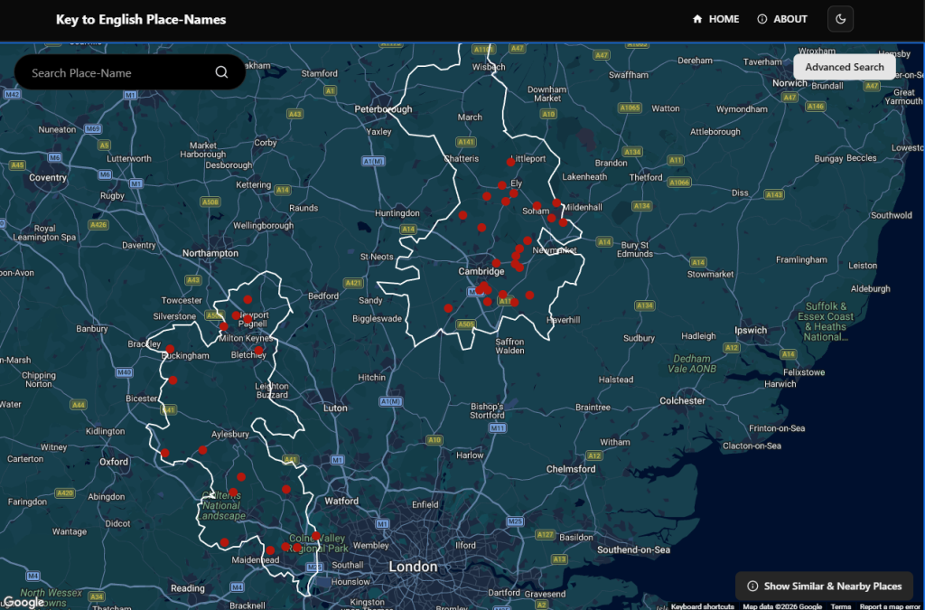
The Advanced Search feature enables multi-criteria queries across the database. Users can filter by:
- County: using boundaries
- Language of origin: Old English, Old Norse, Celtic, Latin, and others
- Name elements: specific morphemes such as “tūn” (farmstead) or “ford” (river crossing)
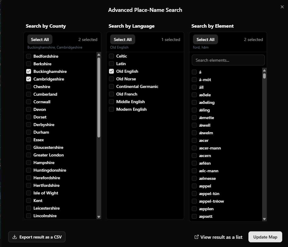
Results are displayed as map markers
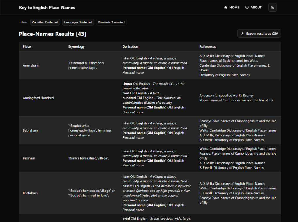
Data Export / View results as a list
Search results can be viewed or exported as CSV for external analysis. Data includes:
- Place name and etymology
- Element derivations with language classifications
- Scholarly references
Tech Stack
.NET 10, Next.js 16, React 19, Tailwind CSS, shadcn/ui, Google Maps API, PostgreSQL, Keycloak
Feature Summary
- Interactive Google Maps interface with county polygon boundaries
- Advanced search by place-name, county, language, and element
- Etymology breakdowns with element and language classification
- Nearby places discovery based on coordinates
- CSV export of search results
- Scholarly reference and citation management
- Keycloak-based authentication with role-based access
- Dark/light theme support
- Responsive design for mobile and desktop
Leave a Reply